World Heritage
Li River Audio Guide (Lijiang)
Between the Yangdi quay and the great bend at Xingping, the Li River threads through clusters of World Heritage limestone peaks, passes beneath a cliff where nine horses are sought and ends in the reflection that China printed on its 20-yuan note.
- 120 min of audio
- Raft trip through the karst
The Li River has been on China’s map for over two thousand years: in 214 BC Qin Shi Huang had the Lingqu Canal cut to join it to the Xiang River and move his armies south, and from then on it formed part of the waterway between the Yangtze and the Pearl River delta. Tang and Song poets turned it into verse and slogan, and in 2014 its karst of peaks in Yangshuo County entered the World Heritage list as part of South China Karst.
The stretch from Yangdi to Xingping, the most prized of the river, holds a game and a banknote. Before the Nine Horses cliff passengers count figures in the rock following a rhyme that assigns each number a rank in the imperial examinations; downstream, the Huangbu shoal reflects the peaks just as they appear on the back of the 20-yuan note, with Yuanbao Hill in the background and a cormorant fisherman on the water.
Highlights
- Nine Horses cliff — A limestone wall with coloured patches and a rhyme that tests whoever counts its figures
- Huangbu shoal — The reflection with Yuanbao Hill that illustrates the 20-yuan note since 2000
- Fengcong karst — Clusters of peaks on a common base, World Heritage since 2014
- Yangdi quay — A raft landing with a mountain-goat legend hidden in its name
- Cormorant fishermen — Conical hat and bamboo pole on the bank at Xingping
Between Guilin and Yangshuo, the Li River (Lijiang, 漓江) threads through limestone mountains that gave China one of its most repeated slogans. Its most famous stretch runs from the Yangdi quay to the great bend at Xingping: a raft trip among clusters of World Heritage peaks, beneath the Nine Horses cliff, to the reflection of the Huangbu shoal that appears on the back of the 20-yuan note.
The history of the Li River begins with a military work. In 214 BC, Qin Shi Huang, first emperor of the Qin dynasty, ordered the Lingqu Canal cut to join the Li with the Xiang River and launch his armies southward; from then on the river formed part of a waterway between the Yangtze valley and the Pearl River delta. How long it is depends on what is counted: 164 km for the Li proper, from the mouth of the Lingqu Canal at Rongjiang to Sanjiangkou, in Pingle, or 437 km for the whole Li-Gui system, which adds the lower course, called the Gui, as far as its confluence with the Xi.
The karst landscape of the Li River is the reason for its fame. In 2014 the Guilin karst entered phase II of the South China Karst World Heritage property, and one of its components, “Guilin Karst – Lijiang Fengcong”, is precisely the peak karst of the river in Yangshuo County. Imperial armies have passed along this channel, poets of the Tang, Song and Qing dynasties, two of the most powerful men of Mao’s China and a President of the United States, and almost all left a phrase or an anecdote on its banks.
To know what to see on the Li River, the audio guide accompanies the crossing in five stops and 120 minutes: the Yangdi quay, the open river off Langshi, the Nine Horses cliff, the Huangbu shoal and the arrival at Xingping. The thread that joins them is a landscape that China has spent twenty-two centuries travelling, singing and, in the end, printing on its money.
The short crossing ends at Xingping Ancient Town; the long cruises continue to Yangshuo and disembark at the foot of Bilian Peak. Downstream, the Li receives the Yulong River, which is descended on a bamboo raft.
Yangdi, the goat’s hoof where the rafts set off
Yangdi quay
Summary of this stop
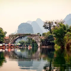
The crossing starts at the Yangdi quay, a landing on the village bank with rows of rafts awaiting their turn and the first peaks closing off the valley. From here leave the motorised bamboo rafts that run the most prized stretch of the river: some go as far as Nine Horses Hill and others continue downstream to Xingping.
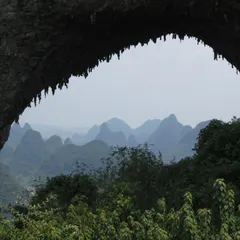
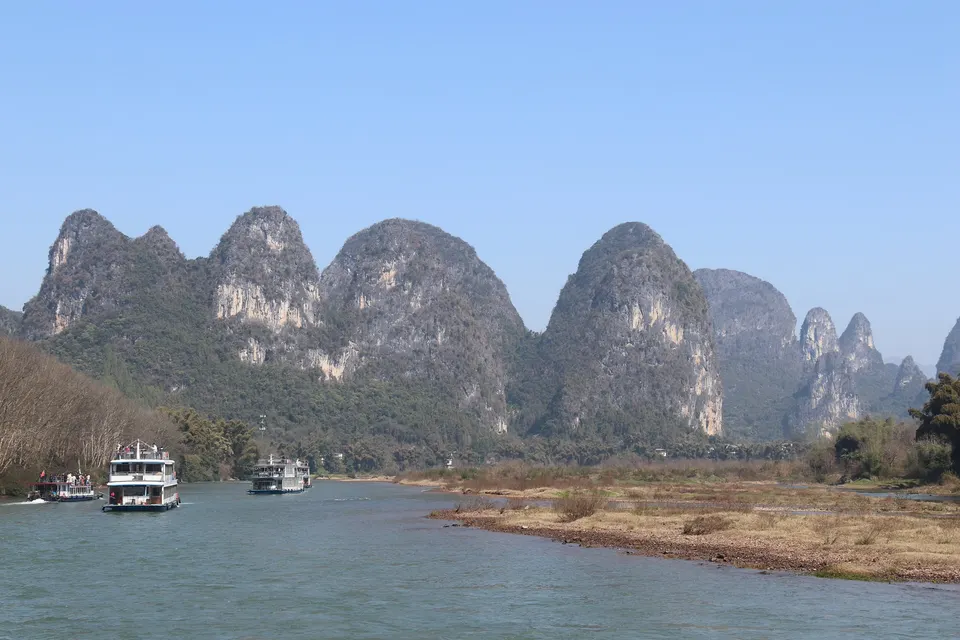
The landscape around the quay is explained by the rock. The Li runs over some 2,600 metres of Devonian and Carboniferous limestone, and along its course the fengcong karst dominates: clusters of peaks sharing one limestone base, with wooded hollows between them, different from the isolated towers, the fenglin of 30 to 80 metres, that surround Yangshuo. Both reliefs have been forming for 10 to 20 million years, and it is these peaks joined at the base that earned the river its World Heritage inscription.
The quay’s very name hides a legend. Local legend says a goat spirit as big as a mountain lived here, devouring the grass of several leagues in a single night until it ended up eating the rice paddies. The Jade Emperor sent the divine giant Juling Shen, who made a field of tender rice sprout as bait, disguised himself as a sapling at the edge and, with two cuts, severed one of the goat’s hind legs and both its horns. The pieces supposedly turned into two mountains, Goat Horns (Yangjiao Shan) and Goat Hoof (Yangti Shan). In the Guilin dialect, yangti sounds the same as Yangdi, and the village swapped the characters for more elegant ones, “poplar dike”, though there are no poplars at Yangdi. As the raft sets off, the audio guide tells how a gluttonous monster ended up naming the quay.
A river opened by an emperor and sung by poets
Langshi
Summary of this stop
Past Yangdi, the river opens off Langshi and the landscape gains silence. Within the “Digital Li” project, the “diesel to electric” programme is replacing the old, noisy, high-consumption diesel-engine rafts in batches with fully electric rafts, which share the channel with the big tourist boats coming down from Guilin.
This channel was a road for armies before it was one for travellers. The Lingqu Canal that Qin Shi Huang ordered opened in 214 BC measured 36.4 km, was designed by Shi Lu and served to launch the imperial troops against the Baiyue tribes of the south. Then came the poets: Han Yu, of the Tang dynasty, summed up the landscape in one line, “the river is a ribbon of blue silk, the mountains hairpins of green jade”, and Wang Zhenggong, of the Song, coined the slogan “Guilin’s scenery is the first under heaven”, which gave these mountains national fame.
The river also received state visits. On 2 July 1998, Bill Clinton came down by boat from Guilin to Yangshuo, some forty miles of winding river among karst formations, bamboo on the banks and villages, accompanied by Hillary Clinton and with a stop to tour the village of Yucun. River guides tell a joke at his expense that has to do with the next bend, and the audio guide saves it for just before the horse test.
Nine horses on a limestone wall
Nine Horses Hill
Summary of this stop
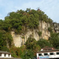
After a bend that opens the view appears the Nine Horses cliff (Nine Horse Fresco Hill), a great wall of white limestone over the river, beside the village of Huashan, whose houses cluster at its foot, some 60 km from Guilin. On the rock, the green, yellow and white patches of stone and vegetation compose the figure of nine horses that gives the place its name. The Qing-dynasty poet Xu Yun wrote before it: “Since ancient times mountains have looked like paintings; now the painting looks like a mountain”.
Passing the wall, passengers play at counting horses following a popular Guilin rhyme: whoever sees seven will be bangyan and whoever sees nine, zhuangyuan, second and first place in the imperial examinations. Almost no one reaches nine, and some count more by adding those reflected in the water. It is said that in 1960 Zhou Enlai saw all nine and Marshal Chen Yi only eight; in another version, Zhou answered “eighteen”, adding the reflections. What survives from that spring is a photo of 15 May 1960 in which Zhou Enlai, Deng Yingchao, Chen Yi and Zhang Qian pose together in a pavilion at Yangshuo.
Legend offers two explanations for those figures. In one, they were celestial horses that the Monkey King, Sun Wukong, was to tend in the stables of heaven; nine escaped and, for not returning, were turned into stone images. In the other, a painter wanted to portray nine horses drinking in the river, and the frightened animals fled against the cliff and were engraved on it. Facing the wall, the audio guide poses the exam and each listener finds out what rank they would have earned in mandarin China.
The 20-yuan note, at full size
Reflections of Huangbu
Summary of this stop
Past the great bend of the river by Xingping, the water slows into the Huangbu shoal, whose name means “yellow cloth”. It owes this to a slab on the riverbed, long and wide, corn-yellow in colour, whose reflection spreads over the water like a cloth. In the shallow stretches, the clear water shows a bed of pebbles.
This is the landscape of Chinese money. The back of the 20-yuan note of the fifth series of the renminbi, in circulation since 16 October 2000 and kept in the 2005 and 2019 editions, reproduces the reflection of the Huangbu shoal with Yuanbao Hill in the background and a cormorant fisherman on the river. The peak that closes the scene is recognised by comparing the landscape with a banknote in hand, and at this point the audio guide accompanies that comparison until paper and river coincide.
Cormorants on the last fisherman’s pole
Xingping
Summary of this stop
The crossing ends on the bank at Xingping, where elderly men in conical hats with bamboo poles pose with cormorants beside the viewpoint of the note. One of them is Huang Yuechuang, a fisherman from the village of Dahebei, of a family that has fished for generations, who since 2000 has posed as the “model fisherman” at the best photo spot of the note’s landscape. In 2022 he was 82: white beard, a cormorant at each end of the pole and a pair of birds he feeds one jin, half a kilo, of fish a day.
Those poles echo an ancient fishing method. The “fishing fires of the Li” were a traditional night fishery: at nightfall fishermen went out on rafts with lit torches and several cormorants, and the lights spattered the river like stars.
Today the river is governed in another way. In the campaign against the “four disorders” of its banks, tourist rafts fell from more than 5,000 to 1,210 and 1,120 riverside farms were closed. On the bank at Xingping, the audio guide closes the journey with the fishermen who keep the image of the note alive and with a river that has chosen fewer rafts and more silence.